Broome Tides
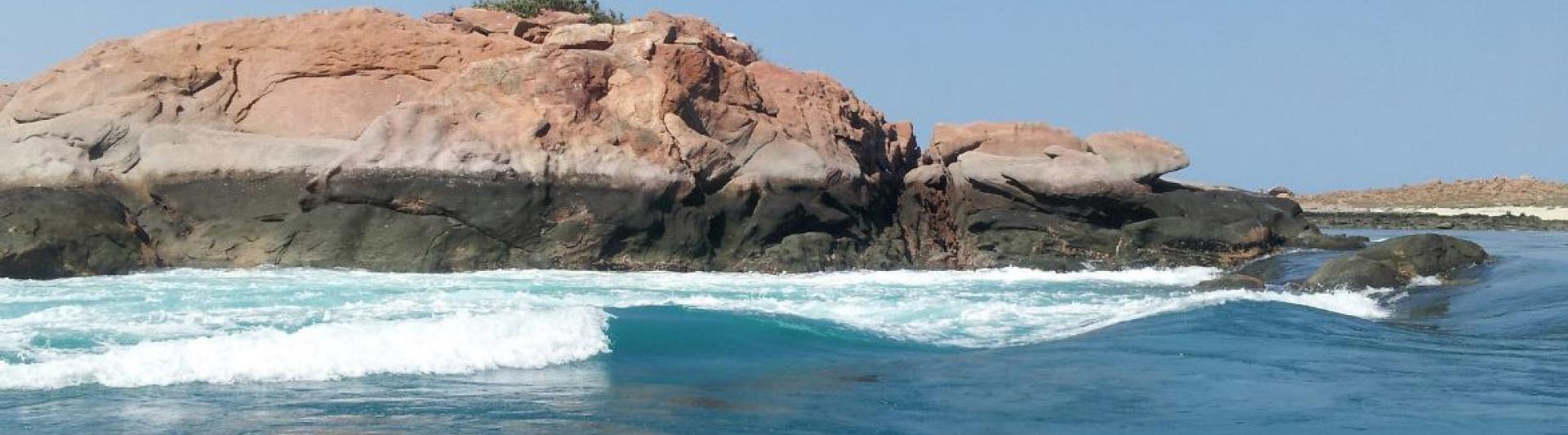
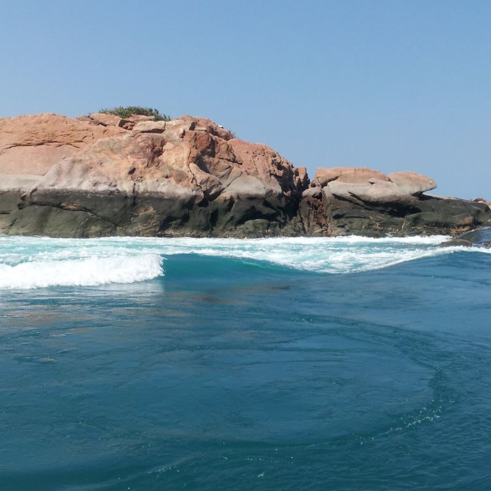
The Kimberley Coast has the biggest tides in the southern hemisphere. The difference between high and low tides is up to around 10 metres. Take time to study our tide charts to make the most of your stay. Low tides offer the best chance to see dinosaur footprints, the flying boat wrecks and the staircase to the moon while knowing when the tide is high can save you getting your car stranded on the beach!
Tide Information
Please find below links to the latest tide information from the Bureau of Meteorology.- 2026 BOM TIDE TABLES FOR BROOME (< Click to download pdf)
All data is copyright: Commonwealth of Australia / Bureau of Meteorology
The Bureau of Meteorology gives no warranty of any kind whether express, implied, statutory or otherwise in respect to the availability, accuracy, currency, completeness, quality or reliability of the information or that the information will be fit for any particular purpose or will not infringe any third party Intellectual Property rights. The Bureau's liability for any loss, damage, cost or expense resulting from use of, or reliance on, the information is entirely excluded.

Neap tides are when there is the smallest difference between low and high tides.
Horizontal Falls Seaplane Adventures do not operate on Neap Tides as below marked in orange.
2026
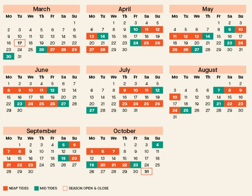
This information was updated 23-4-2026
Neap Tides are part of the normal tidal cycle and occur each month when the sun and moon are at right angles to the earth. During this time, their total gravitational pull on the Earth’s water is weakened because the water flows from two different directions – high tides are lower, and low tides are higher. For this reason, Horizontal Falls Seaplane Adventures do not operate during a neap tide.
Season Opening Dates 2026
MARCH 2026
Bookings available now for the below tours
Broome to Horizontal Falls Half Day Adventure AM (morning)
APRIL 2026
Bookings are now open for the below tours
Broome to Horizontal Falls Half Day Adventure PM (afternoon)
Horizontal Falls & Dampier Peninsula Tour Fly/Drive
Horizontal Falls & Dampier Peninsula Tour Drive/Fly
Ultimate Horizontal Falls Luxury Stay ex Derby
Horizontal Falls Luxury Overnight Stay ex Broome (via Derby)
MAY 2026
Bookings are now open for the below tours
Horizontal Falls Overnight Stay ex Broome (via Derby)
Horizontal Falls Overnight Stay ex Cygnet Bay
Horizontal Falls Overnight Stay ex Derby
Cygnet Bay to Horizontal Falls Half Day Adventures
Derby to Horizontal Falls Half Day Adventure
All overnight stays end 29 Sept 2026.
Half Day Tour ex Derby and ex Cygnet Bay end 30 Sept 2026.
Half Day ex Broome (Aft) and Full Days end mid Oct 2026.
Half Day ex Broome (Morn) ends 31 Oct 2026.
This information was updated 18/05/2026
The power of the Horizontal Falls water flow is determined by fluctuating tidal movements. During mid tides dates, the tidal movements are different to spring tides and there is not as much white wash but the flow is still there.
Horizontal Falls Seaplane Adventures terms and conditions apply to all seaplane adventures with the power boat experiences. "We only operate Tours on days when predicted tidal movements are not Neap. Neap tide block out dates can be found on our website. We also specify particular dates on which water movement is expected to be slow. Water movement may be slow from time-to-time even on dates not designated as ‘slow water’ days due to the changing times of daily tidal movements.
Even so, the Horizontal Falls is a natural phenomenon which is dependent on tides. The experience differs from day-to-day and time-to-time. Although your Tour will include a power boat experience through the location of the Horizontal Falls, we cannot guarantee and we expressly disclaim any guarantee that your Tour through the Horizontal Falls will be at a time when water movement is to your preference. You acknowledge that for safety and cultural reasons, your power boat experience will travel through the ‘wide gap’ and not the ‘narrow gap’.
2026 Mid Tides Dates (marked in green below)
Please call the Broome Visitor Centre 08 9195 2200 if we can help explain anything about the tour options for you.
This information was updated 23/4/2026
You can download the tides schedules for Yampi Sound (Koolan Island) from BOM for 2026 Yampi Sound (Koolan Island) Tides.
2026 Neap & Mid Tides calendar
for Horizontal Falls Seaplane AdventuresNote: All dates/availability are subject to change and local conditions may impact availability.
This information was updated 23/4/2026
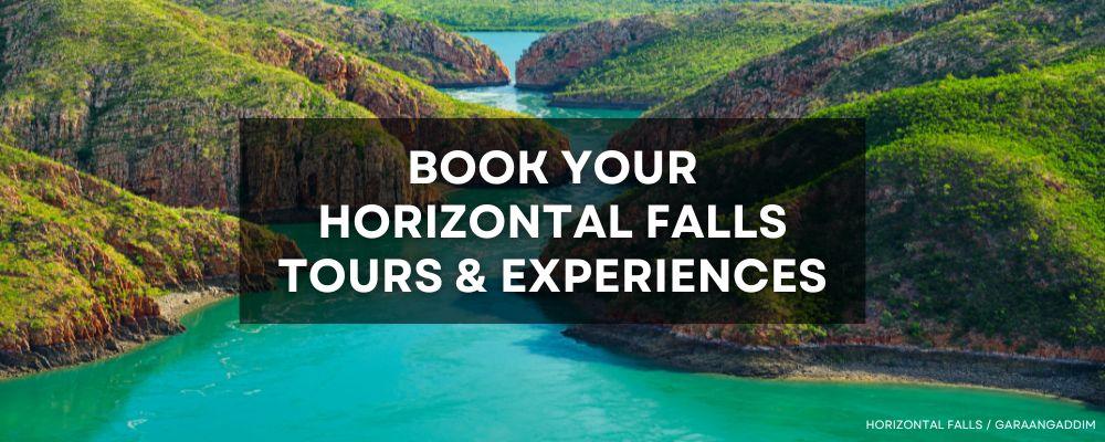
BOOK YOUR HORIZONTAL FALLS SEAPLANE ADVENTURES ONLINE HERE
Please call the Broome Visitor Centre +618 9195 2200 to ask questions, get advice on the tour options and book over the phone.
To this day, the wrecks of some of the aircraft can be seen at very low tide at certain times of the year.
We recommend you allow an hour to walk to out to the wrecks, and an hour to return to shore. Enclosed shoes are also recommended. You must always be safe, be aware of the tides and also be informed of the daylight hours.
The wrecks are protected under the Heritage of Western Australia Act 1990. Please do not disturb them, do not remove artefacts and do not walk on exposed structures.
We have some fantastic photos of the flying boat wrecks in the shallows of Roebuck Bay by Maddison Hall provided for exclusive use to the Broome Visitor Centre here.
Yes, you can book online on very limited dates each year to enjoy a shallow boat tour to the flying boat wrecks. These tours are usually an early start and are a fantastic way to get the full commentary from an experienced guide. Email us if you need more information.
The Broome Historical Museum is a fantastic place to start reading about the Broome air attacks.. They have lots of information as well as books for sale. When you come to Broome, you can visit the museum and see artefacts and learn more. We also have a new art installation near the new jetty at Town Beach called 9 Zeros - 9 Stories which was created to acknowledge the 80th anniversary of the Broome Air Raid.
The giant tides are part of Broome's unique charm, but it is important to know the times of the tides if you plan to drive on Cable Beach or want to try your hand at mud crabbing in Roebuck Bay. View our marked up tides chart for dates when the tides are low enough to walk out to the flying boat wrecks (you will need to ALWAYS cross check the sunrise and sunset times and tide levels and be advised that the walk may be considered strenuous. Be informed and responsible for your own safety).
We suggest you plan a visit to the Broome museum, or read some of the information at the Broome Historical Museum website.

Catalina "Flying Boat" Wrecks
Roebuck Bay contains a sunken armada of World War II flying boat wrecks that are fully visible at tides less than 0.86m. No other place in the world has such a collection of rare and historically significant flying boats. The mud has done a very good job of preserving the aircraft.
At extremely low tides, the plane wrecks are visible to those who wish to walk the kilometre across the Roebuck Bay mud flats from Town Beach.
Submerged by sea, but visible on very low tides, these wrecks are heritage protected and respected by the local community, due to them being 'war graves' of the over 100 lives lost when war came to Broome.
Broome and the pearling industry were impacted by both World Wars. During World War I pearling trade lapsed and hundreds of tonnes of shell were left in warehouses and were ruined. The industry continued after the war, though it never fully regained its earlier momentum.
In February 1942 Allied personnel were ordered to evacuate Dutch East Indies (Indonesia) as an attack by the Japanese was imminent. During February and March over 8000 refugees passed through Broome en route to Perth and Sydney using whatever aircraft was available.
On the 3rd of March 1942, nine Japanese Mitsubishi Zero fighters left Koepang, in Timor, and made a daring air bombardment of Broome. They destroyed fifteen flying boats on Roebuck Bay and six aircraft at the Broome airfield. It is estimated over 100 people died during the attack. Heroic rescues by locals and aircrew saved many lives. The attack left no useable aircraft in Broome.
Read more at the Broome Historical Museum website.

Broome's Unique Dinosaur Footprints
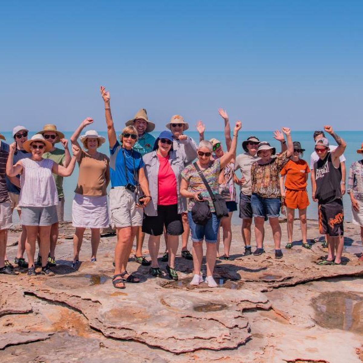
Dinosaur footprints dating back over 120 million years can be seen around the Broome area at certain low tides. Enormous Brontosaurus-type seropod and other theropod dinosaur prints, including Stegosaurus, were laid about 130 million years ago.
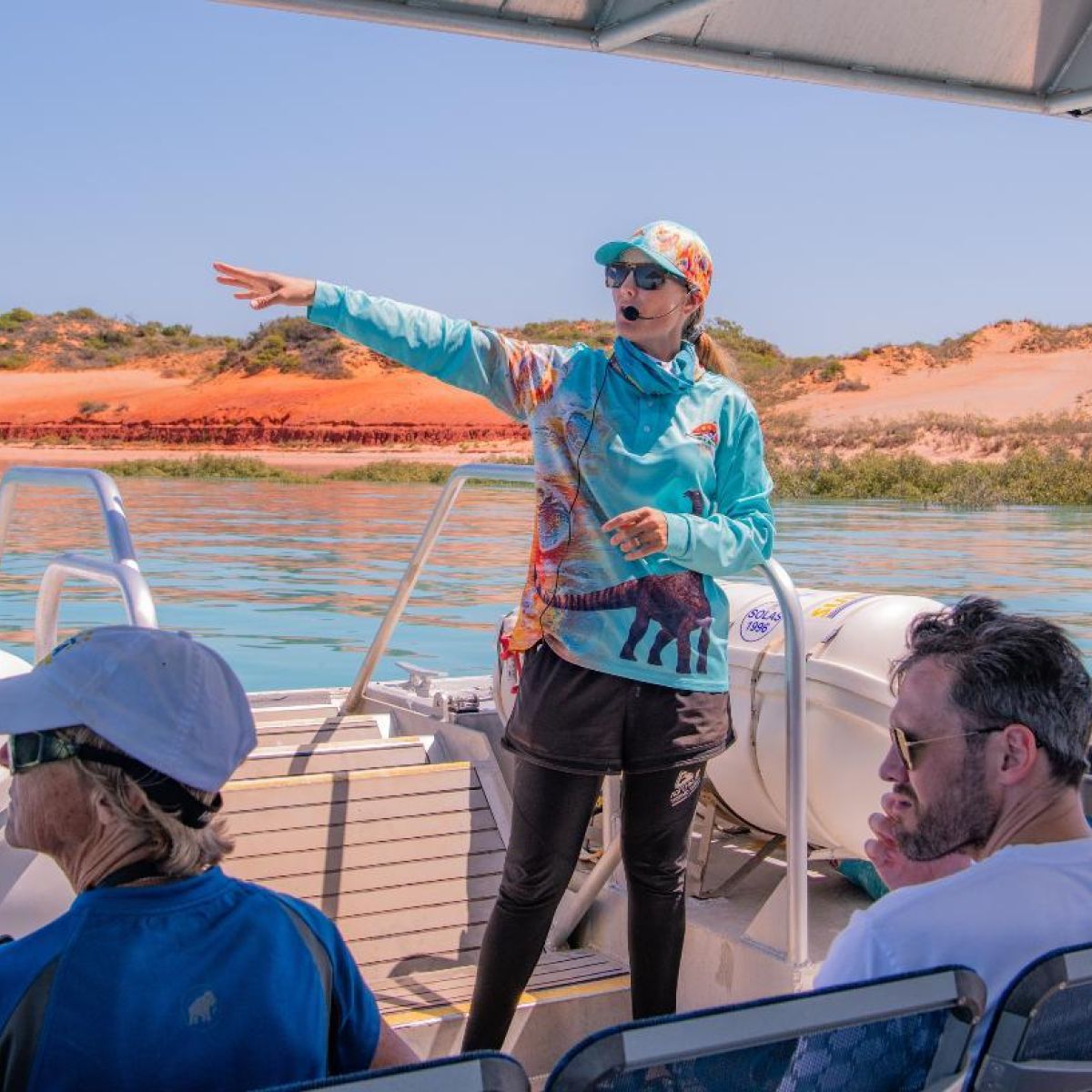
The prints are scattered around Roebuck Bay and along the coast, some can be reached by foot from at Gantheaume Point when tides are below 2.16m, be aware that the rocks are slippery. Other prints are best reached by on tour with Broome Adventure Cruises and walking tours with the team from Broome Dinosaur Experience.
The replica footprints can be found embedded in the rocks near the walkway at Gantheaume Point (no climbing required).
Footprints can be seen at low tide around Cable Beach, Gantheaume Point and Reddell Beach. The Dinosaur Coast Management Group (DCMG) is a not-for-profit organisation, formed in 2015 to protect and promote the dinosaur tracks of the Dampier Peninsula and to educate the public about their cultural and scientific importance. For more information visit the Dinosaur Coast Management Group website.
- There is also a Dinosaur Coast Track Guide app you can download.

Low tide
Uncover some very old and perfectly preserved dinosaur tracks in rock on the beach or marvel at the brightly coloured inhabitants that bask amongst the Mangrove trees lining the coast. You will be amazed by the history that hides on our ocean floor. Join a shallow boat tour featuring the dinosaur footprints with Broome Adventure Cruises. Book your Broome dinosaur footprint shallow boat tours online.
Beach Safety at Cable Beach
The Shire of Broome provides a beach lifeguard service in partnership with West Coast Water Safety and the Broome Surf Life Saving Club with daily patrols of Cable Beach during the dry season. More information here> Broome Shire Beach Patrol
In the interests of public safety and enjoyment, the Shire of Broome provides a beach lifeguard service in partnership with West Coast Water Safety and the Broome Surf Life Saving Club. During the dry/high season there are daily patrols of the swimming area on Cable Beach marked by red and yellow flags in front of the Broome Surf Life Saving Club. Lifeguards provide a first aid and rescue service to the public on Cable Beach and can answer questions relating to beach safety, jellyfish and tides.
During the dry season, Lifeguards can be contacted on 0447 668 300.
During the tropical season months (usually October until early April), Broome's beaches are not patrolled by lifeguards. For assistance or information, contact Shire of Broome Rangers on 08 9191 3456.
Lifeguards return to Cable Beach on Good Friday, 3rd April 2026.
In case of an emergency, call 000.
For information regarding Town Beach Jetty - click here